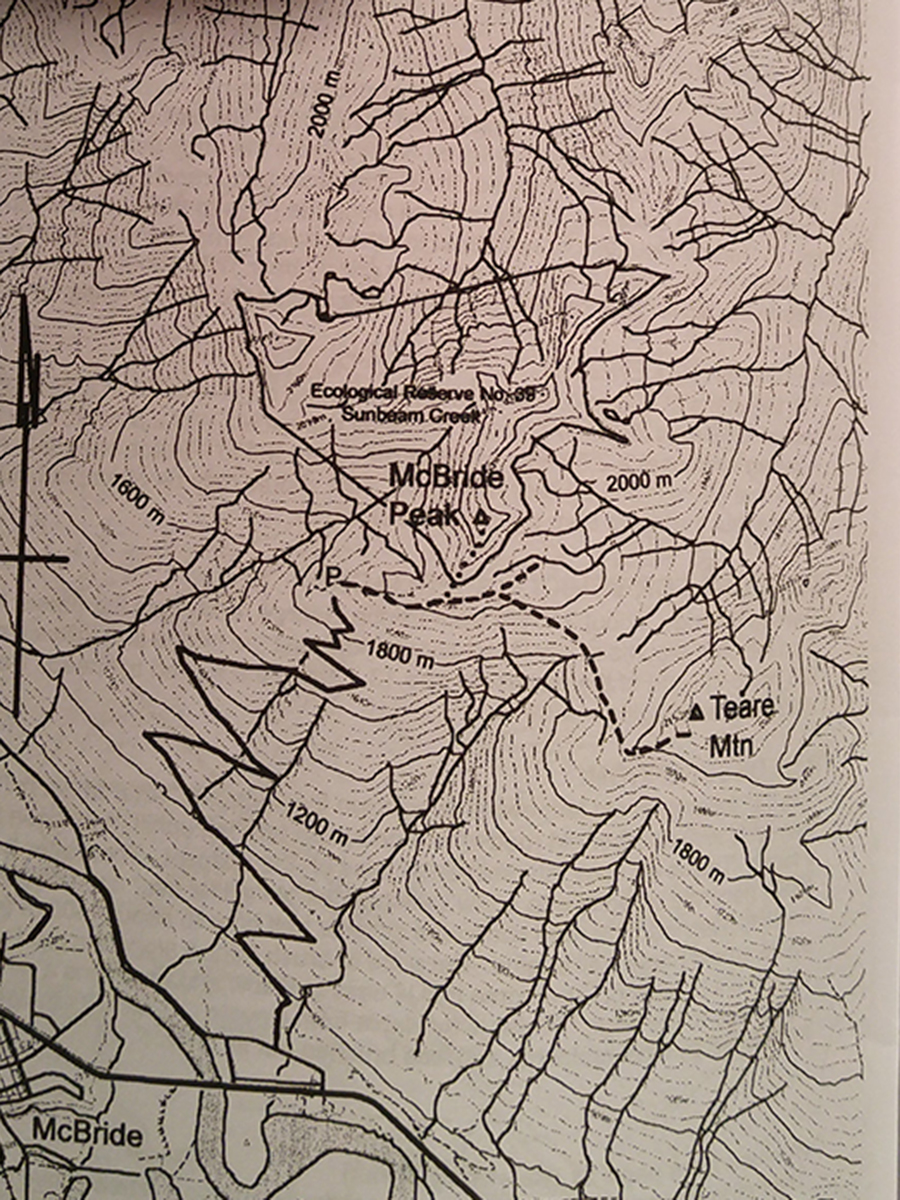
McBride (Teare) Mountain
- Area: McBride
- Length: 2KM
- Elevation Gain: 0M
- Shelter: None
Trail Description
Trails are not really required in the meadow areas where the brush is non existent and trees are few and far between. Do, however, stick to established paths when possible and avoid trampling fragile alpine plants.
Trail Access
Drive east from McBride, taking the second left after the bridge over the Fraser river onto Mountain View Road. Follow Mountainview Road for 0.6km and turn right onto Rainbow Road. You drive close to a house; the road looks like a driveway. After 200m take the left fork. The road makes numerous switchbacks on its way up. Depending on conditions you may be able to drive to the 10.6km to the top, or the clearing half way up. At the top there is a place to turn around.
BackTrail Map