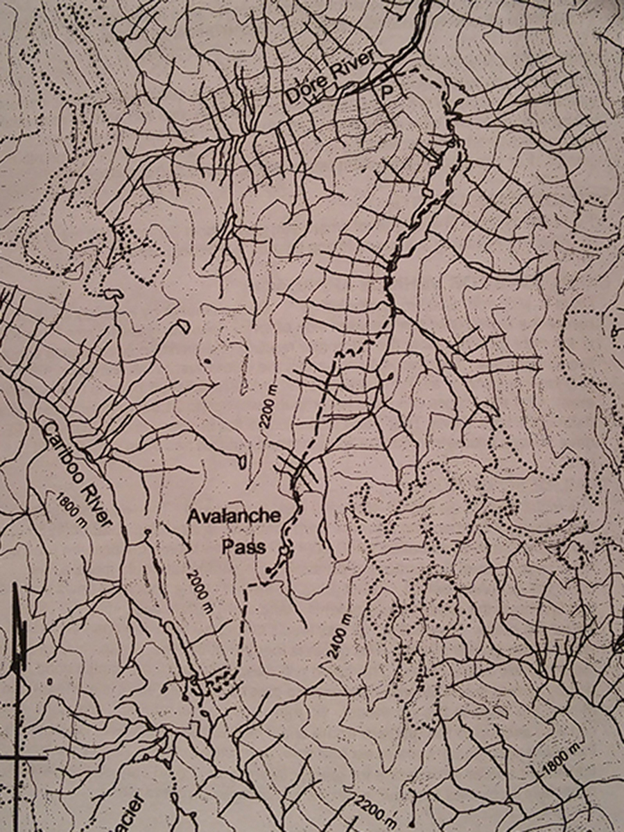
Avalanche Valley
- Area: McBride
- Length: 13KM
- Elevation Gain: 760M
- Shelter: None
Trail Description
The trail follows an old somewhat overgrown skid road ascending on your left as you face the hillside from the parking lot. Follow the skid row for 1 km, reaching an old staging area. After descending slightly, the trail heads up to valley, mostly following the stream. At about 5km the trail ascends up the hill to the right, at first slowly, then by 13 switchbacks to a meadow and great view points partway up the hill. The trail continues ascending the valley eventually passing the last trees where there are a couple of campsites. It then crosses a stream to the left and ascends steeply to the head of the valley where there are a number of small lakes. The trail continues to the right attaining the pass. Once at the pass, traverse around to the left (south), checking for trail markers on the open slope. Eventually the trail descends making a number of switchbacks, finally reaching Cariboo Lake below.
Trail Access
From McBride, drive west on Highway 16, cross the Dore River Bridge and take a left onto the Dore River Road. Note the Odometer reading. Thence: 2km – paved road ends, 4.1km – Cross Dore river to east side, 8.3km – take left fork, 18.4km – drive past the Eagle Valley Turn off, 25.5km – reach the parking area at the end of the road.
BackTrail Map