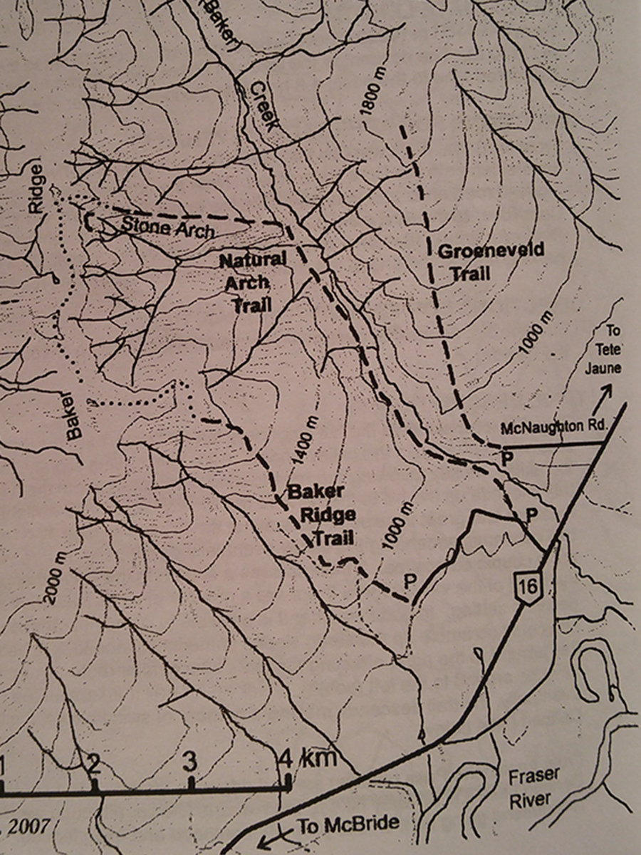
Baker Ridge Trail
- Area: Dunster
- Length: 5KM
- Elevation Gain: 915M
- Shelter: None
Trail Description
From the end of the road, follow an old skid road roughly towards McBride. At the end of the logging look for flagging tape making the trail into the woods. This very short connector trail joins the Old Baker Ridge Trail only 15 m past the edge of the logged area. Turn right and proceed up the mountain. The trail is actually an old bulldozed fireguard, which turns into a hand built trail for the final km or so of treeline. The fireguard section becomes quite bushy but see sufficient quads to keep the brush down somewhat. Some sections of the trail are steep.
Trail Access
From Valemount follow Highway 5 to the Tet Jaune junction, then take Highway 16 wet to Baker Creek Rest area. A narrow road, paved for the first hundred yards, leaves the highway nearly opposite the rest area. Follow this road a short distance to the trail sign for the Baker Arch Trail, stay on the forest road. After making a broad right-hand turn onto the mountainside, cross ditches will be encountered. The road is only suitable for high clearance vehicles beyond this point. Keep the uppermost road at all intersections. After three switchbacks, the end of the road is reached. There is good parking in one of three unused logging landings.
BackTrail Map