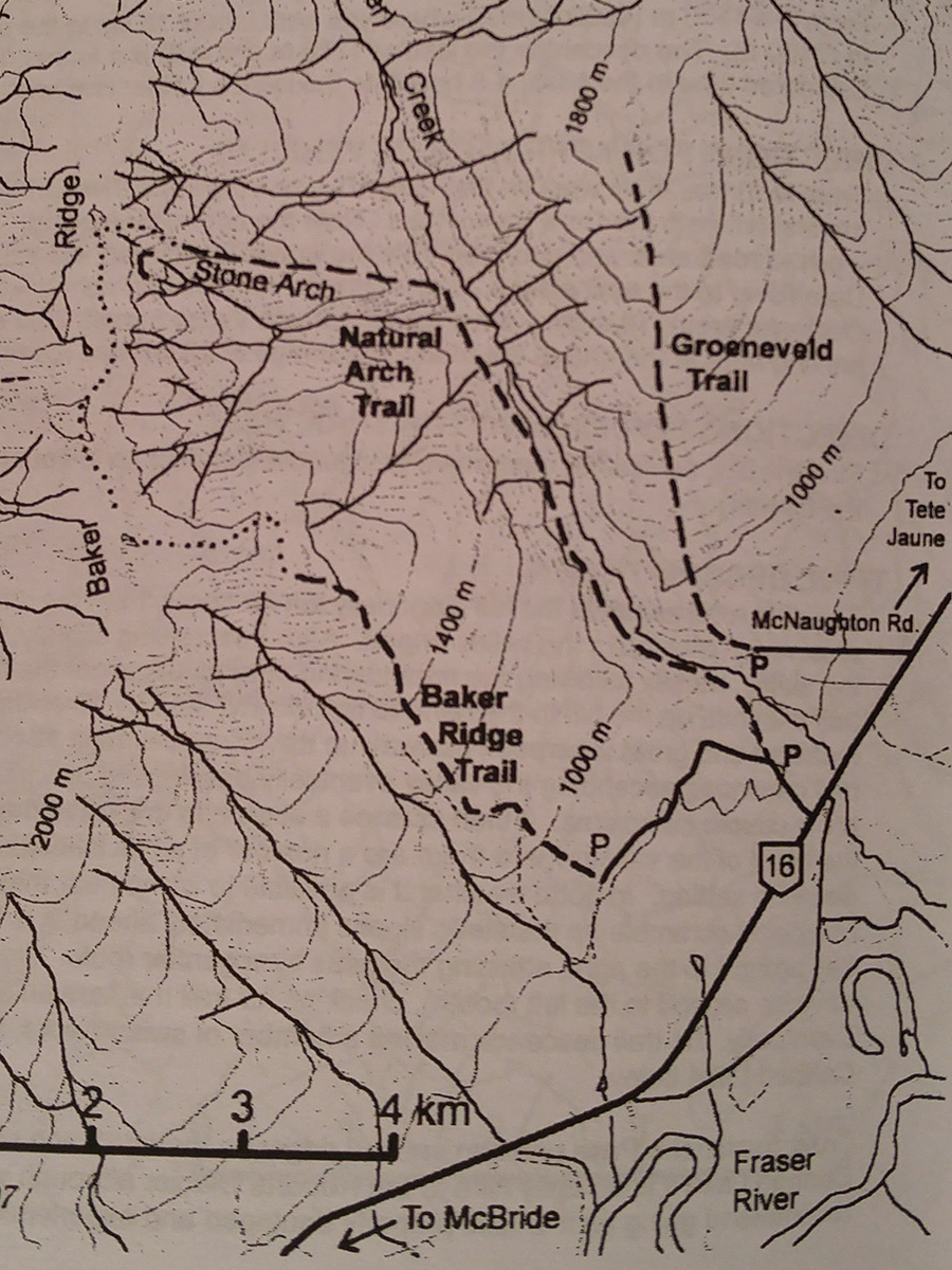
Natural Arch
- Area: Dunster
- Length: 6KM
- Elevation Gain: 915M
- Shelter: None
Trail Description
The trail follows the left side of the creek for about 4.5km, passing a trapper’s cabin. The trail has received little maintenance lately and is currently in very bad shape, particularly along Holiday Creek. There are a number of slips and undercutting of the stream bank, obliterating the trail completely in several places. This trail should be used with extreme caution. By experienced hikers only. The trail heads steeply uphill after crossing a side creek at 4.5km. Here is conditions begin to improve, but the climb is quite steep. It continues uphill for 1.7km where the first view of the arch may be had. From here, strong experienced hikers may continue up the goat trail to the top of the ridge and into the alpine, making a circle route. Hike southwest along the skyline to the top of Baker Ridge Trail, then down that trail and back along the road to the three tiered sign.
Trail Access
From Valemount follow Highway 5 to the Tet Jaune junction, then take Highway 16 wet to Baker Creek Rest area. A narrow road, paved for the first hundred yards, leaves the highway nearly opposite the rest area. Follow this road a short distance to a three tiered BC Forest Service trail sign. Park Well off the road.
BackTrail Map