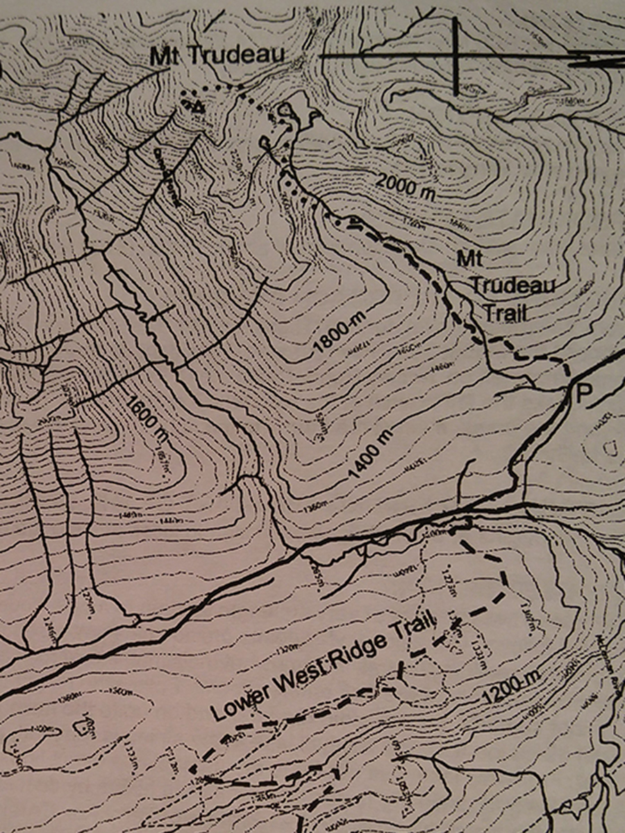
Mt Trudeau
- Area: Valemount
- Length: 12KM
- Elevation Gain: 366M
- Shelter: None
Trail Description
The trail ascends through old logging. Crossing a creek on a foot log, it enters older forest and climbs steeply to high bench lands, arriving at open subalpine wetlands in the basin above. Near the upper end of the basin is a small round lake. Above this lake the terrain opens up but no marked rout exists. To visit more lakes or climb the summit, ascend a greasy area with boulders on your left and brush on your right. Once above the brush angle to the right to arrive on a bench across which the creek flows. Cross the creek and continue angling to the right to find a route up to the next bench, which has a number of lakes on it.
Trail Access
From Valemount, travel south on Highway 5 to the first intersection south of town, about 3km. Here turn right and follow the overhead powerlines along the back roads until see a BC Hydro substation on your left. Continue on past the substation where a sign indicates you are now on km 0 of West Ridge Forest Road. Drive about 14.7km up the forest road where a large sign marks the trail head.
BackTrail Map