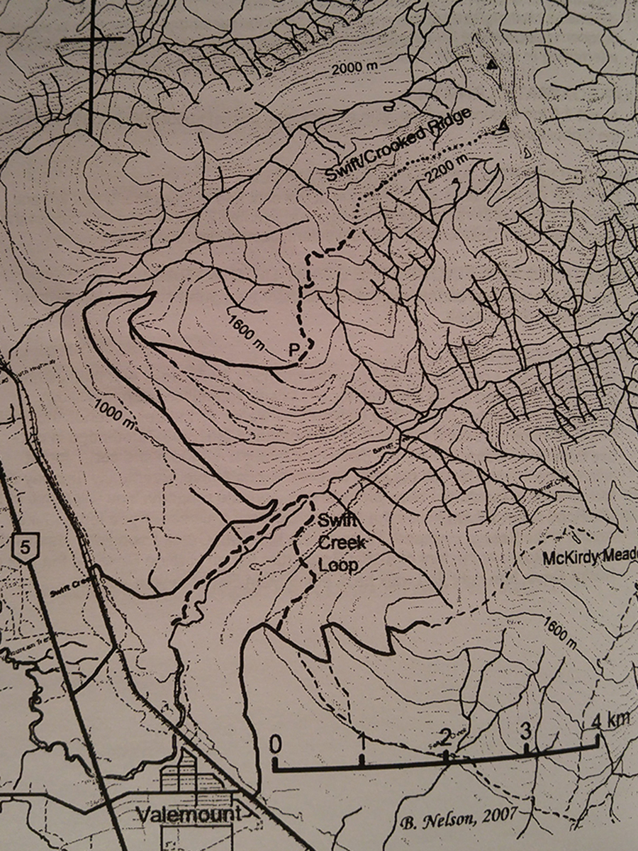
Swift / Crooked Creek Ridge
- Area: Valemount
- Length: 3KM
- Elevation Gain: 800M
- Shelter: None
Trail Description
The trail follows a fairly recent fireguard, leaving the landing at a steep uphill angle. At the end of the road a faint trail is flagged to the right and up the treeline. A pleasant ridge walk is possible along the height of the land between Swift Creek and Crooked Creek.
Trail Access
Travel north from Valemount on Highway 5 for 1 KM. Turn right on Loseth Road. Watch for railroad tracks on your right and take the first side road that crossed the tracks. Keep right across bench lands to the foot of the mountain, then “take the high road†at all intersections except as noted below. The road has “water bars†on steep section to reduce erosion and may not be passible without 4WD. After a long fairly steep ascent through young pine trees the road forks. The branches come together again after a short distance, the lower branch was in better condition at the time of writing. Park at the landing just past where the two branches reconnect.
BackTrail Map