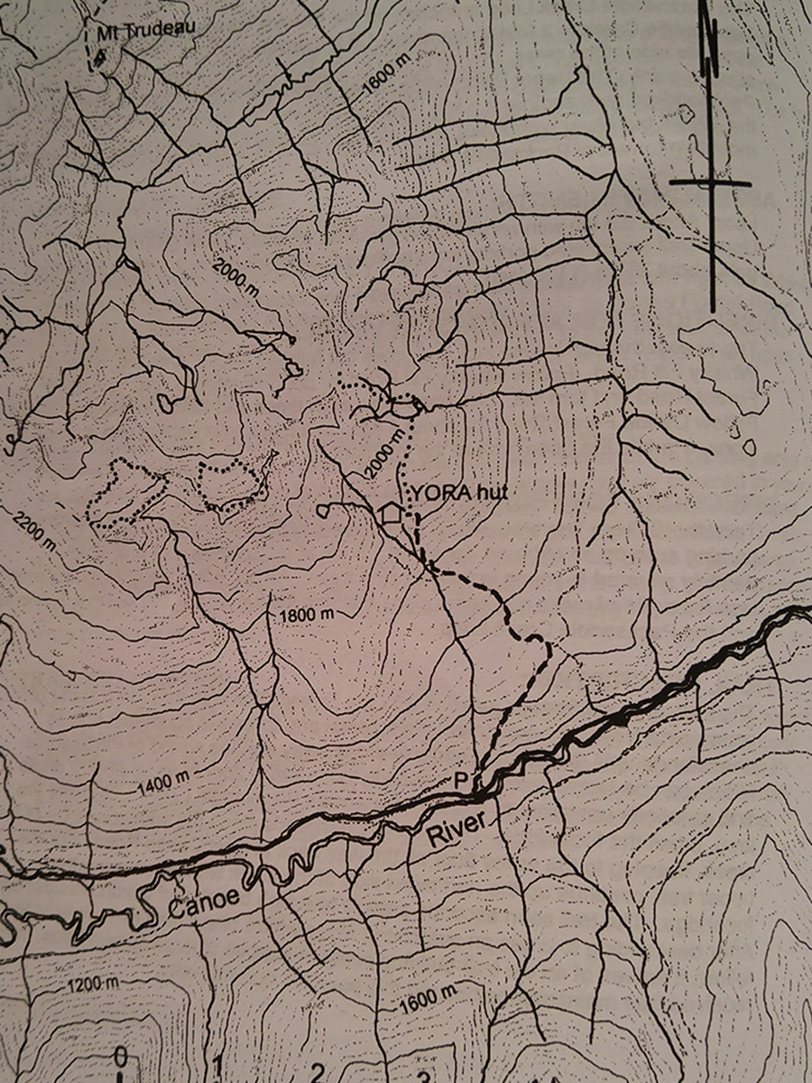
Upper West Ridge
- Area: Valemount
- Length: 4KM
- Elevation Gain: 760M
- Shelter: Hut
Trail Description
The trail ascends an old fireguard with very steep sections. It then descends slightly and turns left, ascending another fireguard that finally becomes a fairly well-trodden footpath. The trail continues to climb steeply and finally enters a rather boggy meadow. The Cabin is to the left at the edge of this meadow. From the cabin, it is possible to walk uphill through parklike subalpine areas until you reach the timberline. Here you can explore extensive alpine areas and two nearby lakes.
Trail Access
From Valemount , travel south on Highway 5 to the first intersection south of towns, about 3km. Here turn right and follow “CMH Cariboo’s†signs for 12.1km to a BC forest service trail sign that includes the “hiking man“ symbol. Park in a small area on the left.
BackTrail Map