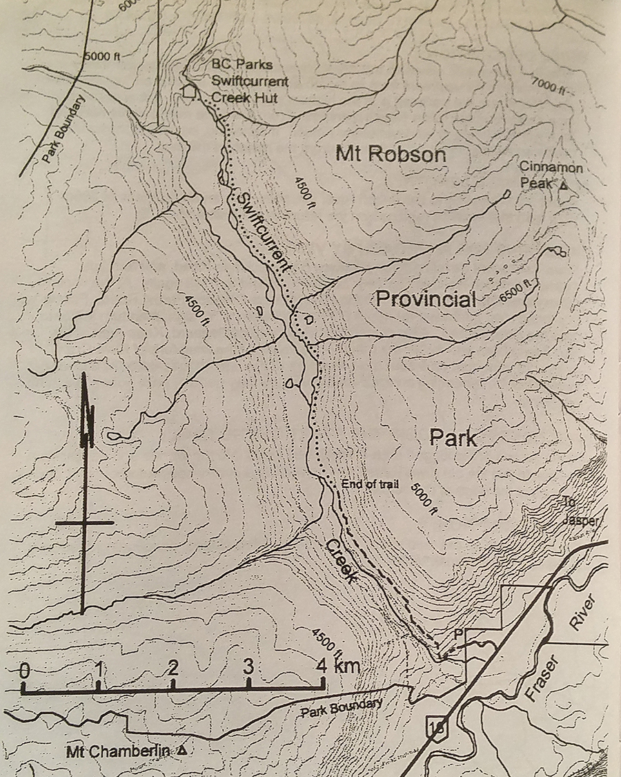
Swift Current Creek
- Area: MtRobson
- Length: 10KM
- Elevation Gain: 200M
- Shelter: Hut
Trail Description
Although primarily intended for horses, this trail has sturdy wooden bridges over wet spots. It ascends steeply for a short distance to reach bench lands above Howard Road, then traverses along the eastside of swift current Creek valley. The trail gradually approaches the creek until a short descent brings you to the foot of the gravel flats. If you wish to ascend the flats, there are currently three places where hikers may have to bushwhack in the forest (for 400m, 160m and 200m respectively) where the creek is right up against the east side of the open flats. In LOW WATER SEASON ONLY, some may prefer to hike straight up the middle of the open flats, crossing and re crossing the meandering creek. The east bank then has 4km of unobstructed hiking through broad river meadows. The cabin is at the upper end of the flats on the west bank of the creek. It is currently necessary to go over a rock bluff or ford a swift, rocky part of the creek to get to it.
Trail Access
From the junction of highway 5 and 16 at Tete Jaune, travel east on highway 16 to the Swift Current Bridge, the first bridge east of the junction. Just after the bridge turn left onto Howard Road. Continue to the turn around at the end of the maintained road. Follow the old unmaintained portion of Howard Road beyond the turnaround for about 190 meters. Near the site of the former bridge across the Swift Current Creek, the trail ascends steeply to the right. There are no signs marking the trail head.
BackTrail Map