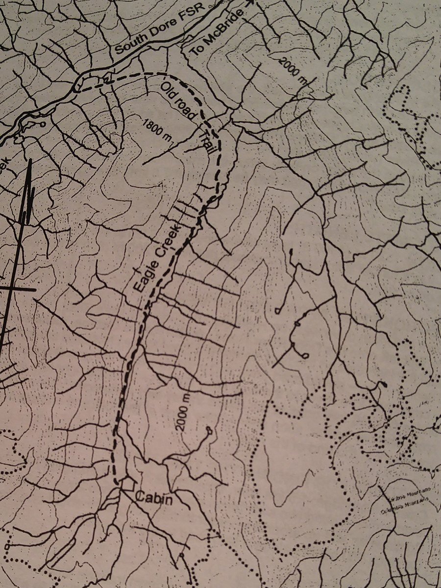
Eagle Creek
- Area: McBride
- Length: 9KM
- Elevation Gain: 0M
- Shelter: Hut
Trail Description
The initial 3km is up the deactivated road to the road end. The well constructed trail then makes a descending traverse from road to Eagle Creek elevation. There is a large open area at the bottom of an avalanche chute. About 4km up the valley bottom narrows and the trail first hugs the creek before ascending the slopes above the creek. Thereafter the trail levels off off before reaching open area with views of the glacier. The cabin is located at the treeline and sleeps 8 to 10 people.
Trail Access
From McBride, travel west to the Dore River Road, turn left and not the odometer. Thence: 4.1km cross the Dore River to the east side, 8.3km take the left fork, 18.4km Cross the Dore River to the west side, 21.5km take the left fork and park across the bridge.
BackTrail Map