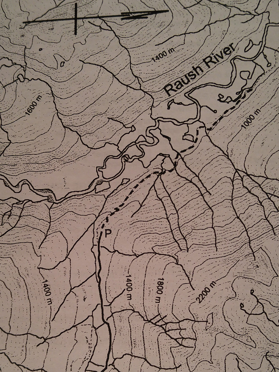
Kiwa / Raush Creeks
- Area: Dunster
- Length: 4KM
- Elevation Gain: 0M
- Shelter: None
Trail Description
At the far end of the cut block a rough trail leads into the woods and descends a few feet to join the old Kiwa/Raush Road. Avoid a debris covered section of the old road at the edge of the cut block. The trail follows an old road which traverses the forested slopes, descending to the floor of the Raush Valley.
Trail Access
From Valemount travel north on Highway 5 to Blackman Road and turn left. Follow Blackman Road to Old Tete Jaune Rd and turn left again. At the second railway crossing the road becomes the Tete Jaune -Croydon Forest Road. Follow this forest road northwest for about 9.5km to a Y sign, then turn left onto the Kiwa Forest Road. After crossing the a bridge and a cattle guard, keep right at the next intersection and follow the road up the valley of the west fork of the Kiwa Creek. At KM 28, turn right on a spur road, park at the end of it, in the middle of a clear-cut. If the road is in poor condition you may need to park before this point.
BackTrail Map