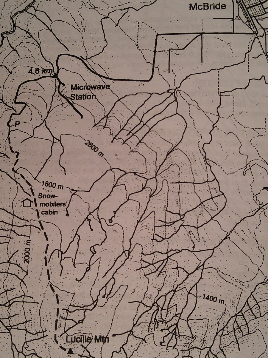
Lucille Mountain
- Area: McBride
- Length: 7KM
- Elevation Gain: 0M
- Shelter: Hut
Trail Description
Basically the trail is an old road up to the alpine, one is not likely to lose the way. The first sub-alpine meadows are reached in about 35 minutes. There is water and a good campsite at the treeline. The snowmobile cabin is a bit further.
Trail Access
Enter McBride via Main Street, turn left onto 1st Ave then turn right and pass under the CNR tracks. Follow the main road which turns into the Lucille Mountain Forest Road after 2.7km. Follow the forest road uphill to about the 4.6km point and turn right onto an older looking side road. Drive another 3km to a logging landing and park. It is possible to go further with 1 to 2 km further with 4WD.
BackTrail Map