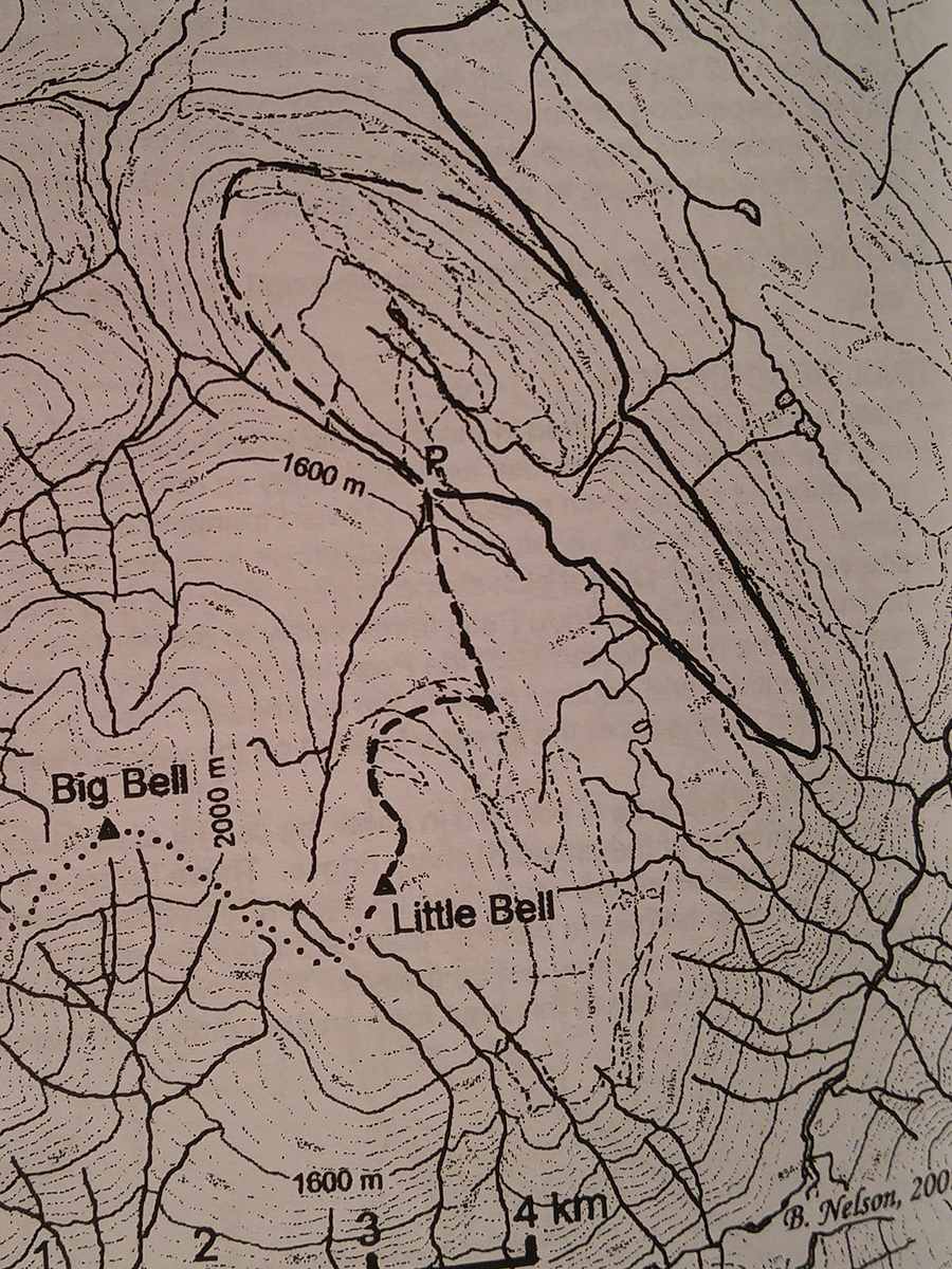
Bell Mountain
- Area: McBride
- Length: 4KM
- Elevation Gain: 0M
- Shelter: None
Trail Description
From the FS campsite, the road can be followed to the alpine. At the edge of the alpine are the remains of an old rope tow that operated in the 60’s for two winters. Once in the alpine, one can see the terrain and there are no markers. If it is foggy, use extreme caution. One can hike directly ahead to the summit of Little Bell and continue on to Big Bell.
Trail Access
Tun onto Bell Mountain Road, about 6km west of McBride. Start measuring the distance from the highway. Thence: 1km - keep right, 3.7km - keep left, 4.7km - snowmobile parking, ski cabin to the left, 7.6km - bear left. The road should be okay to about 11km with 2WD, 14.4km with a 4WD where there is an old Forest Service campsite at 1500m elevation.
BackTrail Map